
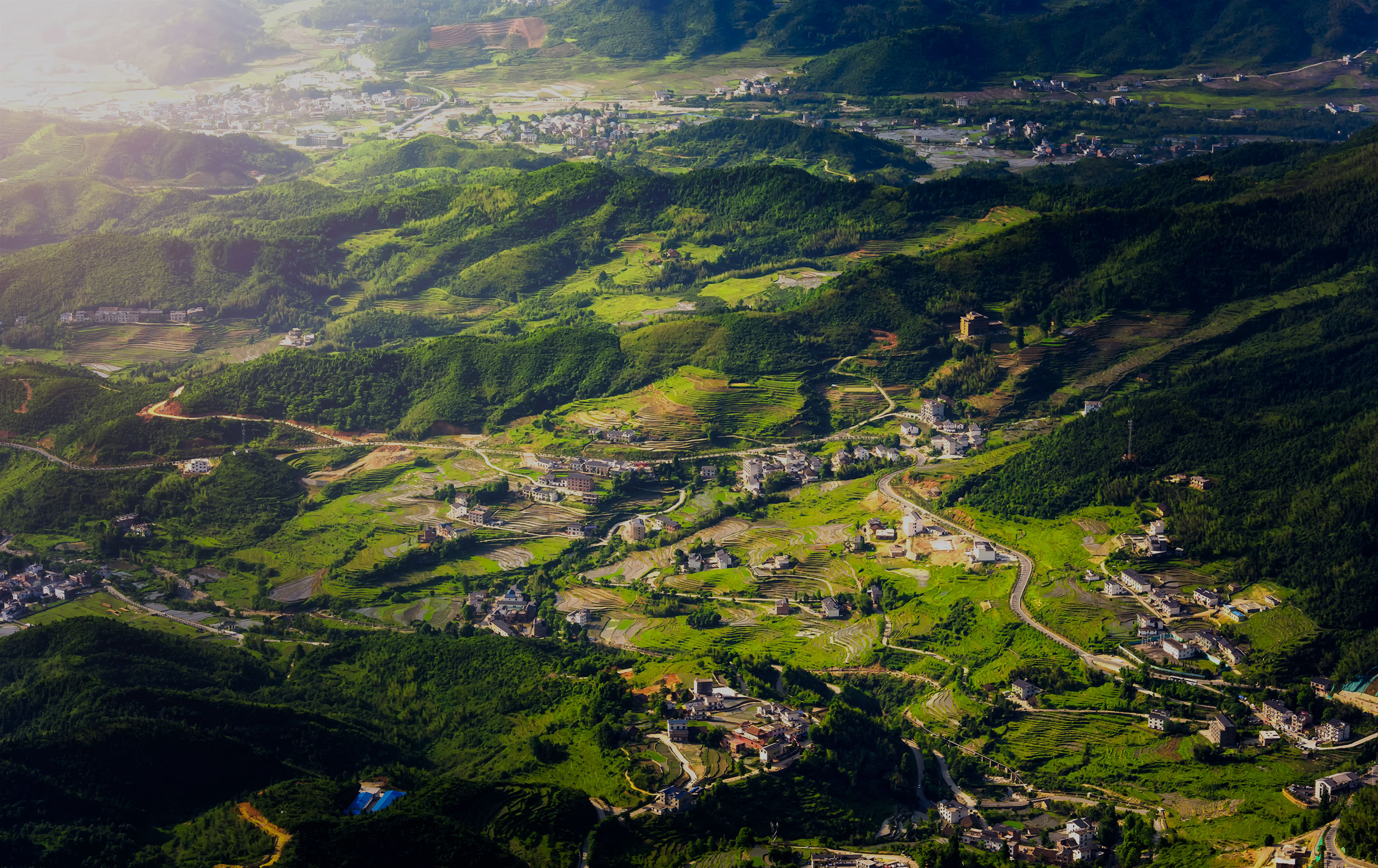
Topographic survey
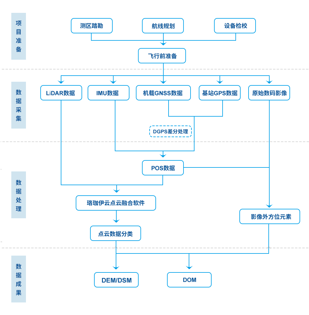
Project flow chart
Project flow chart
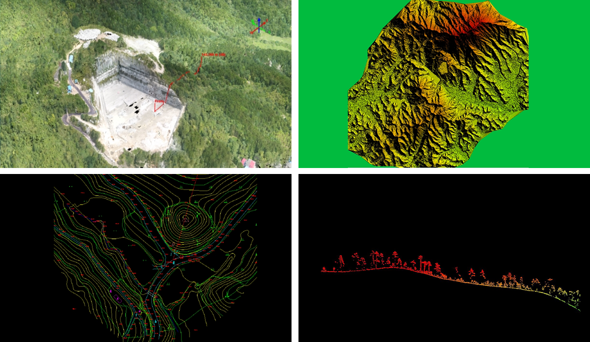
Case presentation
Case presentation
In areas with complex terrain conditions and difficult access for personnel, traditional terrain surveying and mapping methods have many limitations in the operation process, such as high construction difficulty, low efficiency and long cycle. Airborne Lidar surveying and mapping technology digital, accurate, fast, non-contact characteristics can just avoid such problems, the use of laser high penetration, in some extreme survey area environment to make up for the limitations of traditional terrain mapping, providing a new technical means and methods for digital mapping.