
LiDAR
FT-3000Ultra long ranging airborne LiDAR, supporting multi-sensor fusion and ALV (Anti Light Velocity) function.

The FT-3000 airborne LiDAR integrates multiple core performances and excels in detection capabilities and functional integration. With a high laser pulse repetition rate of 2000 kHz and an ultra-long measurement range of 3620 meters (@80% reflectivity), it achieves stable high-frequency detection.With a repeatability of 5mm@100m(1σ) and a relative accuracy of 5cm, it can mapping precisely. Stronger penetration capability with 16 echoes to collection more terrain data. It supports the ALV (Anti-Light Velocity) function, namely the real-time online processing capability to counteract light-speed limitations. This function enables multiple laser pulses to be present in the air simultaneously at any moment, enhancing point cloud density and measurement accuracy while significantly improving the operational efficiency of the LiDAR system. Meanwhile, it supports four sets of customizable camera systems, enabling the fusion of multi-modal data. It is widely used in scenarios such as mine surveying, mapping and exploration, and natural resource surveys.
Optical Parameters
|
Laser Class |
Class 1 |
|
Laser Wavelength |
1550nm |
|
Beam Divergence |
0.28mrad |
|
Measurement Range |
10m~1800m@20% |
|
Laser Pulse Repetition Rate |
100k~1000kHz |
|
Field of View |
75° |
|
Angular Measurement Resolution |
0.001° |
|
Measurement Technique |
TOF |
|
Scan Rate |
60~400 lines/s |
Laser Parameters
|
Repeatability Accuracy |
5mm@100m(1σ) |
|
Number of Echoes |
16 Echoes |
|
Echo Signal Intensity |
8 bit (radiometric calibration ) |
POS Measurement
|
Attitude Accuracy(RMS) |
(R;P;H):0.005°;0.005°;0.01° |
|
Post Processing Positioning Accuracy |
Horizontal:0.01m; Vertical: 0.02m |
|
Data Updating Rate |
600Hz |
System Accuracy
|
GNSS PPK High-Precision Mode + Inertial Smoothing |
Horizontal 0.05m; Elevation 0.05m |
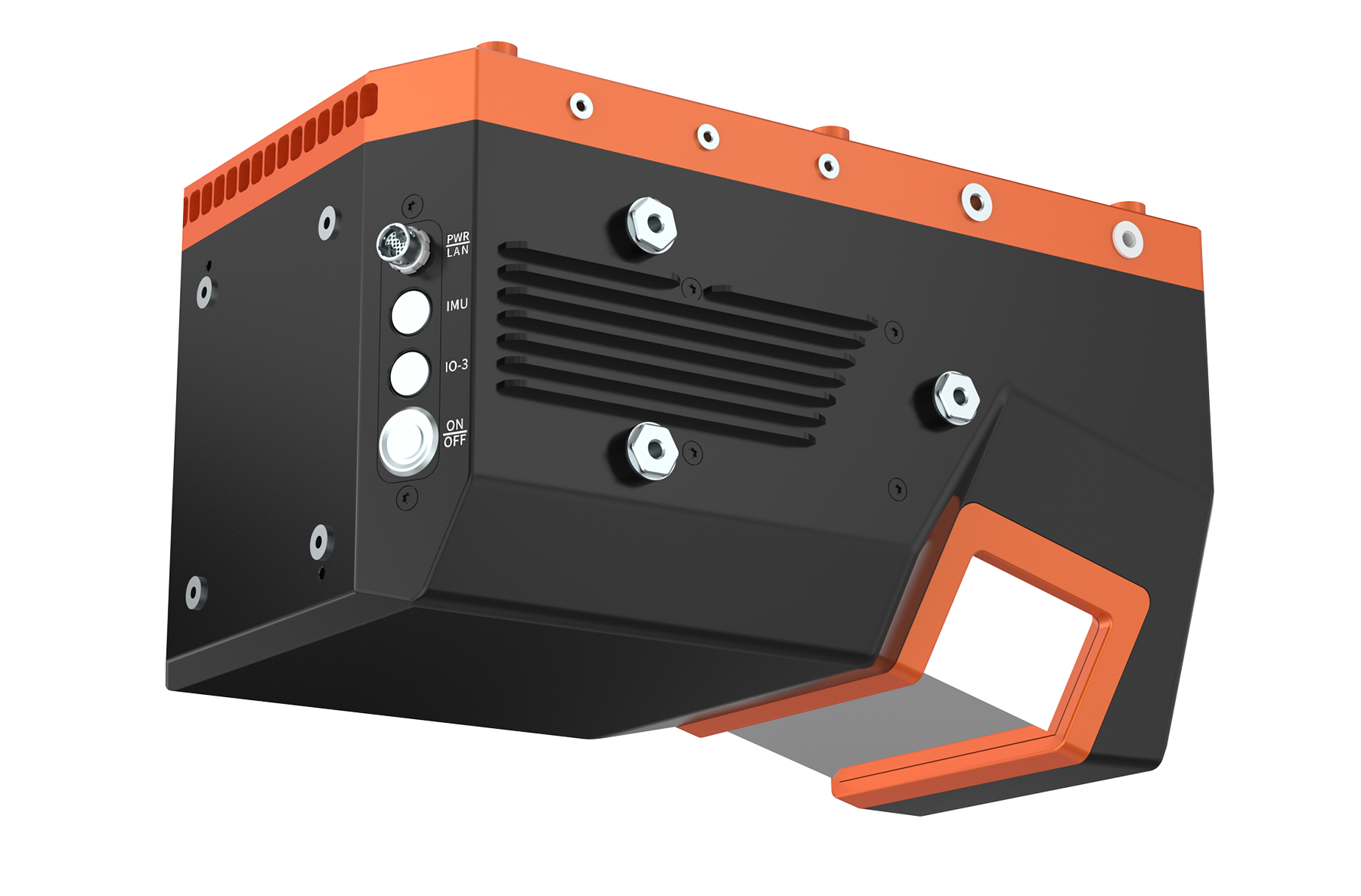
Size
|
Weight |
About 4.5 kg (including IMU, GNSS, and storage) |
|
Dimension |
L×W×H 272×179×163 mm |
Work Environment
|
Storage Temperature |
-20℃~+50℃ |
|
Operating Temperature |
-20℃~ +50℃ |
|
Light Conditions |
Natural Environment |
|
Humidity |
Non-condensing |
|
Protection Level |
IP64 |
Power Source
|
Rated Voltage |
Typical 24 VDC (supports 20V-30V input range) |
|
Power Consumption
|
Approximately 80 W(Does not include external IMU and camera) |
Data Interface
|
Bus(PWR/LAN)
|
24V Voltage Input; External GNSS SynchronizationSignal Input/RS232 SynchronizationInterface |
|
Camera Interface (101) |
External Camera Interface |
|
Camera Interface (102) |
External Camera Interface |
|
Camera Interface (103) |
External Camera Interface |
|
IMU Interface (IMU) |
Connect Any External IMU |
|
RF Interface (GPS Antenna) |
GPS Timing Inside the System |