
Laser Scanner
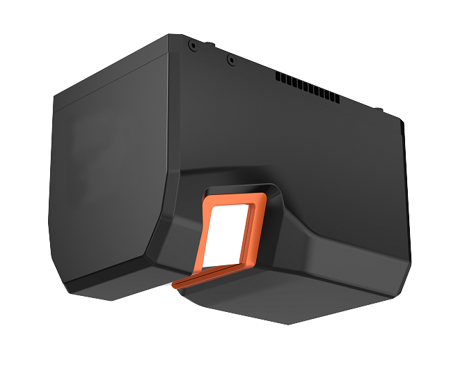
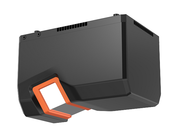
FT-2000H Airborne Laser ScannerLong-range, high-precision airborne laser scanner for versatile application developments.

- All
- FT-MINI Airborne Laser Scanner
- FT-800 Airborne LiDAR System
- FT-800H Airborne Laser Scanner
- FT-1200 Airborne LiDAR System
- FT-1200H Airborne Laser Scanner
- FT-1500 Airborne LiDAR System
- FT-1500H Airborne Laser Scanner
- MT-HEX Airborne LiDAR System
- MT-HEX Airborne Laser Scanner
- FT-2000 Airborne LiDAR System
- FT-2000H Airborne Laser Scanner
- FT-3000 Airborne LiDAR System
- PRO-360 Mobile Laser Scanner
- D-800 Mobile Laser Scanner
The FT-2000H is a high-performance airborne laser scanner weighing approximately 2.1 kg. It can be flexibly integrated into various UAV platforms, and its open data interfaces support multi-sensor collaboration. With a maximum measurement range of 2,520 m (at 80% reflectivity) , a repeatability of 3 mm @ 100 m, and support for up to 16 target returns, the system offers exceptional vegetation penetration capability. Its 75° wide field of view and maximum pulse repetition rate of 2,000 kHz, combined with ALV (Anti-Light Velocity) - a real-time online processing function that overcomes the speed-of-light limitation - significantly enhance point cloud density and operational efficiency. Widely used in applications such as topographic mapping, power line inspection, and 3D reality modeling, the FT-2000H is an ideal solution for long-range, high-precision 3D geospatial data acquisition.
Optical parameter
| Laser Class | Class 1 |
| Laser Wavelength | 1550 nm |
| Beam Divergence | 0.5 mrad |
| Measurement Range | 10 m~2520 m@80% |
| Laser Pulse Repetition Rate | 100 k ~ 2000 kHz |
| Field of View | 75° |
| Angular Measurement Resolution | 0.001° |
| Measurement Technique | Pulse-phase ranging |
| Scan Rate | 80~400 lines/sec |
Laser measurement
| Repeatability Precision | 3 mm@100m(1σ) |
| Max. Number of Targets Per Pulse | Up to 16 echoes |
| Echo Signal Intensity | 8bit (Radiation correction) |
Dimension
| Weight | Approx. 2.1 kg |
| Size | Length * width * height |
| 205*127*141 mm |
Working environment
| Operating Temperature Range | -20℃~ +50℃ |
| Storage Temperature Range | -20℃~ +50℃ |
| Light condition | Natural environment |
| Humidity | Non-condensing |
| Protection Class | IP64 |
Power source
| Power Supply Input Voltage | 24V DC(20 V to 32 V input range) |
| Power Consumption | Approx. 55W |
Data interface
| TCP/IP | Gigabit Ethernet |
| PPS Synchronization Signal | Falling Edge Valid (TTL Level) |
| GNSS Signal Reception | RX (TTL Level) |
<